The Ignite @ Where2.0 in San Jose, CA
Monday 28th 6:30 PM - 9:00 PM @ Where2.0 Fairmont San Jose, Ca
It was the Ignite Where evening when I arrived to San Jose on the 28th. There were 16 talks each lasting only 5 minutes held at the San Jose Fairmont Hotel and moderated by Brady Forest, O'reilly . The audience voted on the best talks with Mozes and two talks did make it to the mainstage during the Where2.0 conference .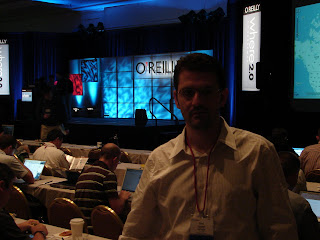 "Emad at the Where2.0 Conference May, 28th"
Some of the presentations were:
1. FatDoor is a neighborhood-based community social network. It aims to help you to know more about your neighbors.
2. GeoCommons is a community that enables the collective creation of intelligent maps. With access to a huge new world of geographic data and infinite ways to combine it, GeoCommons empowers you with the tools to gain and share insight across your neighborhood or across the globe.
3. Dopplr is a calendar and location focused social network. It helps you answer the question: "Who do I know in *this* city right now?. Dopplr is currently a private beta.
4. Swivel is a place for exploring data and share your insights with others. Swivel has data about politics, economics, weather, sports, business and more. Swivel explore, compare, share and upload data
5. NationalGeographic Meta Lens is the premier geospatial solution for geo-referencing, management, retrieval, and real-time delivery of digital media.
6. Hipoqih.com, presented by Diego Fernández Domínguez from Spain - is a service composed of a Web and plugin for mobile devices that allow recording warnings and URL associated to any geopoint in the planet. These warnings can be show automatically in terminals with the plugin when approaching that geopoint.
7. Friends of the Urban Forest OSGEO Presented by Amber Bieg, San Francisco. Friends of the Urban Forest, a non-profit tree group dives into osgeo and the difference it makes mapping trees.
Ignite Talks
Tagzania, presented by Luistxo Fernandez. Tagzania is a mashup tagging world locations. Tagzania is a social mapping application, very tied to tagging, folksonomy. If Europe is some sort of periphery as seen from the SF Bay area, we're in the periphery of the periphery, a small Basque company pushing a global website, from somewhere in Northern Spain. But geography is not constrained to a central point, specially since there's Internet, and this European and 'fringe' viewpoint might be interesting: Europe's multilingual, multi-national, full of governments not very friendly with the idea of opening public cartography...Slideshow available at SlideShow
Twittervision presented by David Troy, Popvox. Twittervision visualize traffic on the emerging service Twitter. It intbegrate blogging, location-based services, and text messaging. Twitter and Twittervision provide rich presence of location based services. Twittervision just recently launched it's API, this is a great opportunites for mobile location based services.
Upnext is a 3D virtual cityscape where users can explore and discover their city. UpNext empowers users to search visually, straight from their web browser, to find out what's down the block, in the neighborhood, or all the way across town. We bring the immersive and explorative qualities of virtual worlds to local search.


No comments:
Post a Comment